
Ghosts and Meanders
The shortest distance between two points is a debt unpaid

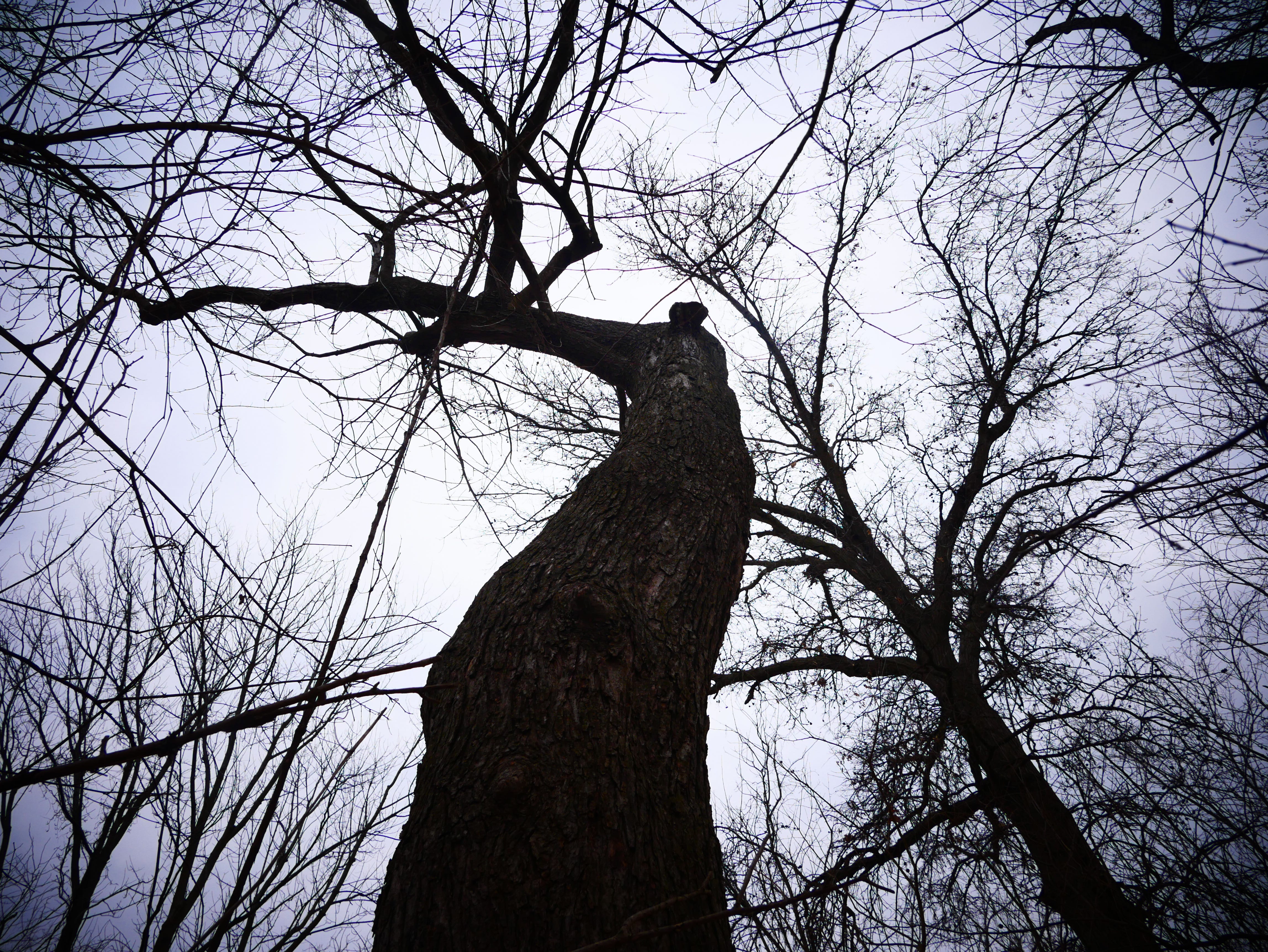
Walking down in the dead thatch and frozen clay alongside the Long Branch Creek with my dog tromping near, I pause at the form of a crooked old maple, its stems tipped with bleak, bloody buds, unmoving. We’ve set nearly 70 or so taps in the past two weeks to collect tree sugar from maple, walnut and birch. I check the bucket lying at the gnarled base of the old mother maple, and it is entirely empty. Besides a short run in the first few days, the trickle of thin woody sap has ceased altogether– the days quickly grew too warm, and now, too cold. In spite of the battling air masses overhead, nothing much has changed down below.
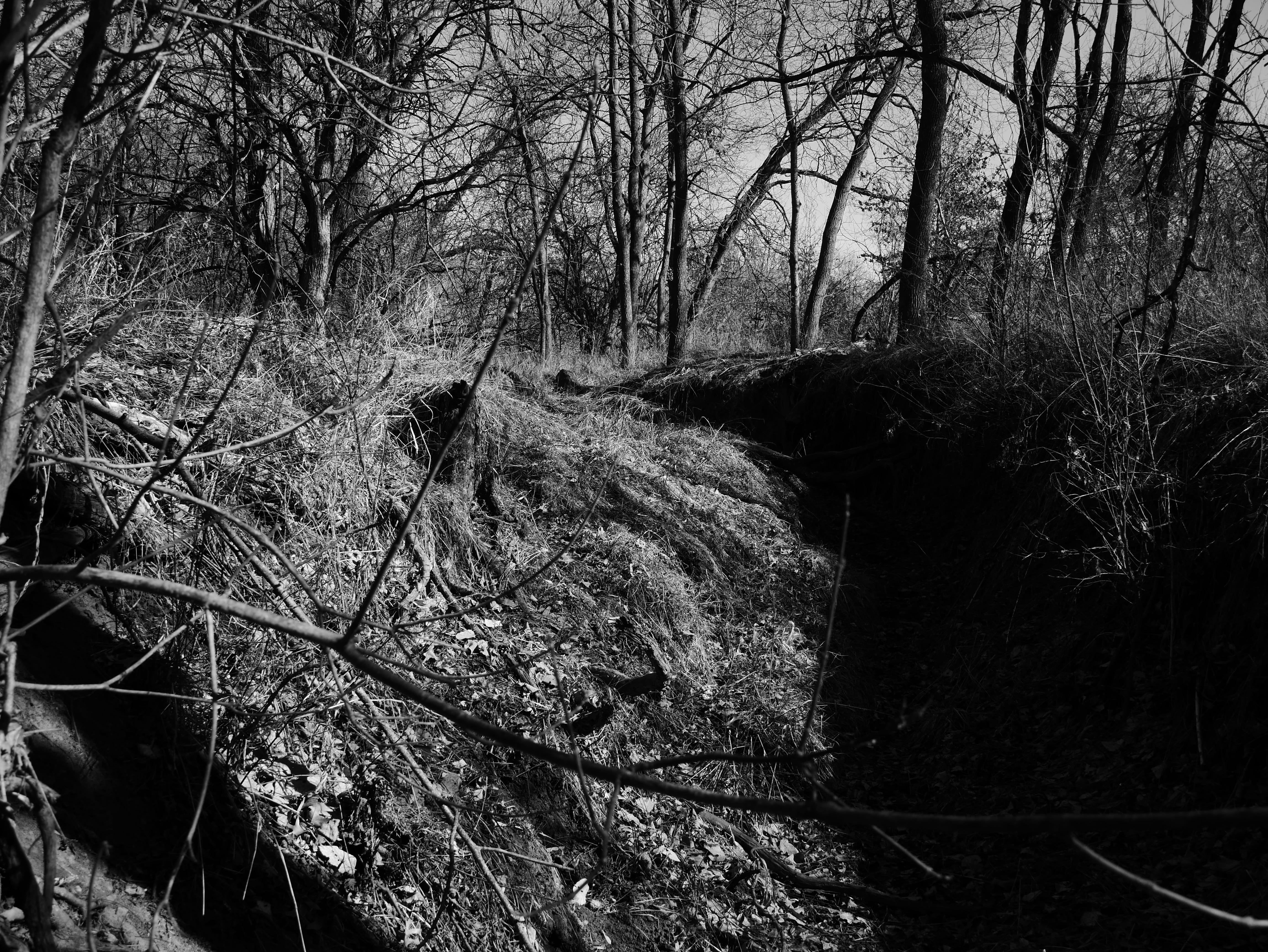
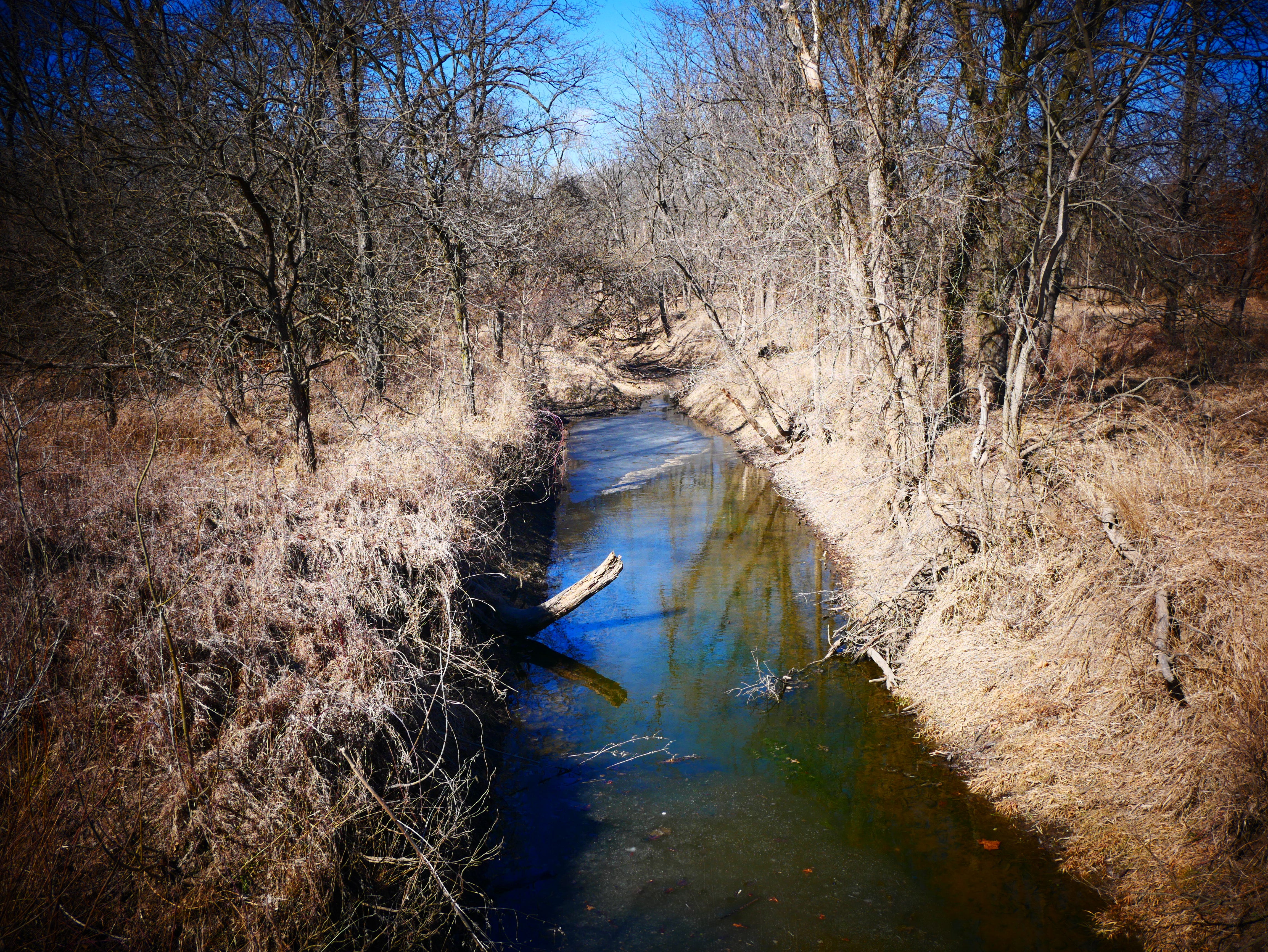
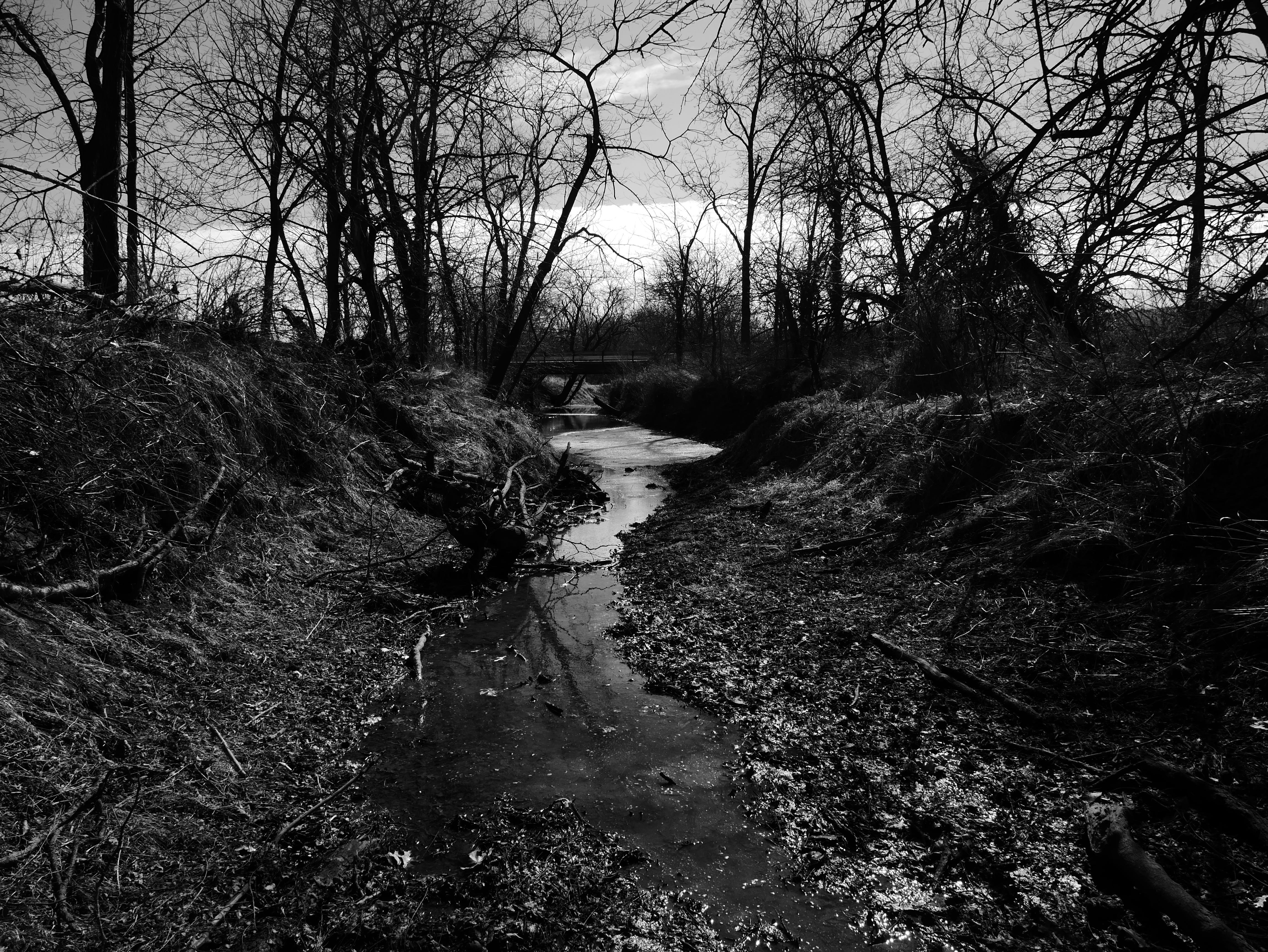
A thin shelf of algae-riddled ice clouds the mirror of a low pool in the stasis of the Long Branch– sheltered from the sun by root-mat and muddy bank. The Long Branch is a ragged, intermittent watercourse with well-defined, steep banks locked by knotted roots. In the dry times, such as these, it is a mere linear collection of pools, strung together through ramparts of muddy logs, the mucky bottoms speckled with raccoon prints, deer trails scratched across her banks. In the spring rains, she swells with brown water, alluvium and detritus, wood ducks dabbling in the muddy calm, rising above her banks in floods to inundate the quilt of woodland and farmfield that rolls alongside her for a dozen miles, crusting the leaves of overhanging maple in fine, gray silt before depositing into the south fork of the Middle Fabius, and on along towards the Mississippi. She is a minor waterway, like so many here in the patchwork of plowed-out slopes and narrow wooded draws that make up our corner of Northeast Missouri, enough of a landmark to be given a name, but mostly lying silent, stretched between the sycamore leaves and rotted-out carcasses of old oak, like a snake retreated in the duff.
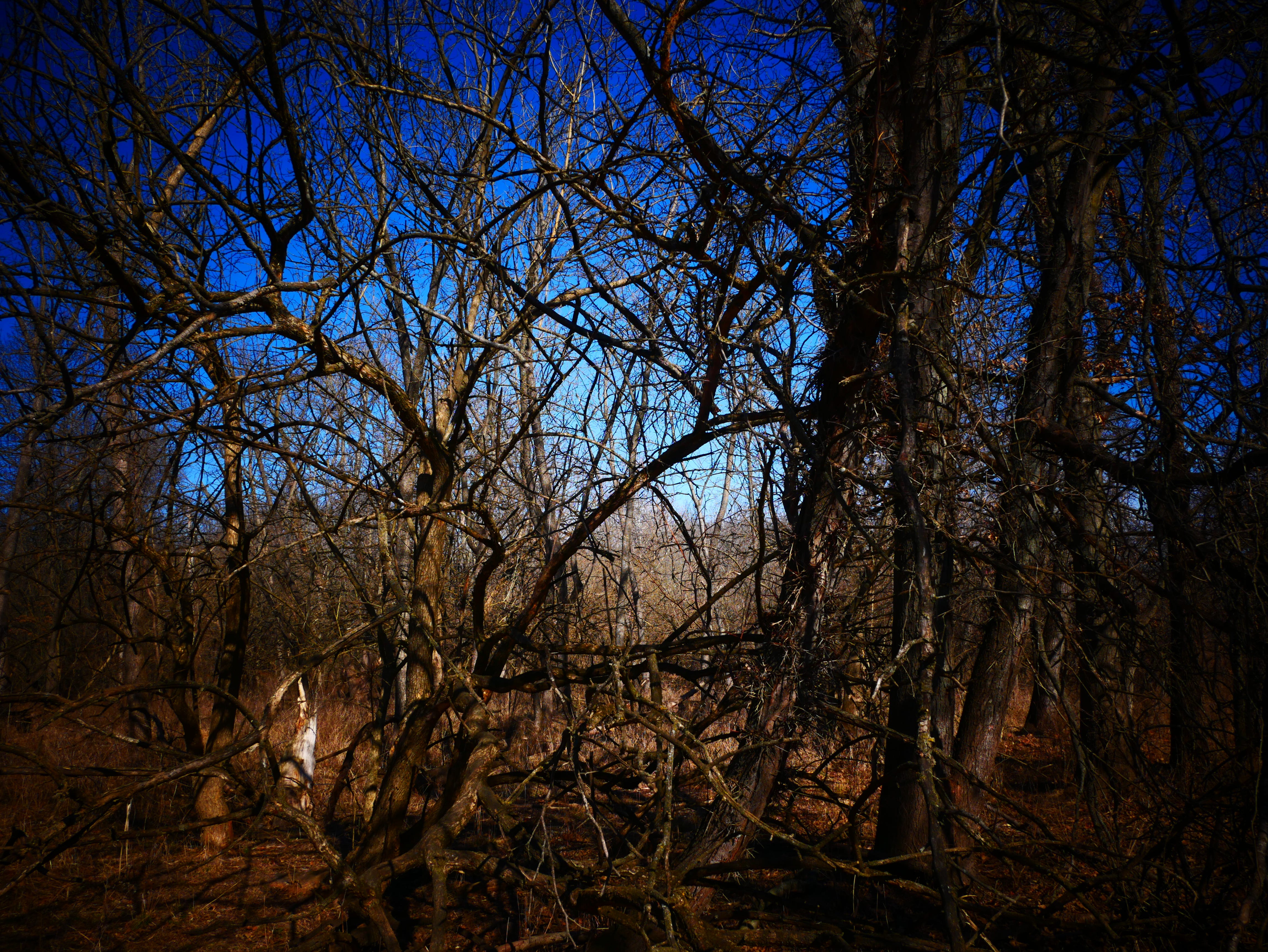
Bucket by bucket, my dog and I skulk along the sleeping bottomlands, kicking at the empty vessels. Some crows have returned to watch us, the only thing moving up in the bare-leaf canopy, the buds of oak and elm not even gleaming with spring renewal. A muted sun is pressing against screens of haze, the air neither particularly cold or warm. The brambles are barren of flitting birds, the matted balls of oak-leaf woven together as squirrel dreys swaying vacant in the skein of gray vapor. Without bushy-tails to rouse or turkeys to flush, my dog even seems to be bored in the unchanging expanse of faded, sleeping grass and shiftless, frozen clay. At the end of the bucket-line, we veer up through the dormant prairie slopes and towards home with no sap, hearing only the echo and groan of creek ice grinding against branch and mud.
But of course, there’s what I can see, and what I can’t. A few inches behind her rough bark, the maple’s stasis has already shattered. Somewhere down deep, like the groan of ice melting, an alchemical hum is amplifying in the xylem. In roots pushing through the unyielding clay, last summer’s sunlight starch is stirring, becoming sugar, pulsing like a heartbeat without a heart. I don’t know how much we’ll collect before leaf-out, when enzymatic shifts turn the sap “buddy” and unpalatable, which is why I’m experimenting with slower to awaken trees like walnut and birch– in a climate where early spring hot spells are becoming increasingly common, maple sugar is the canary in the coal-mine, if not the passenger pigeon. A stretch of just a few warm days can end the harvest, breaking the vacuum of freeze and thaw.
Anyone who has made their way into and out of these kinds of bottomlands, especially with cartloads of sugaring equipment, understands that traversing riparian areas can be a bit perilous. Pathways that appear relatively clear from a distance are suddenly, inevitably obstructed by the slumped corpses of wind-fall limbs. Spreading thorny growth reaches out to snag human trespassers. Stumps, branches and ankle-breaker sinkholes lay in wait, concealed beneath the grass. When the sap is running fast and the buckets need to be gathered, the earth often melts into a tractionless mire. I have fallen on my ass along the Long Branch for a decade and a half— there is no skillful way to navigate it in mud season, as a bipedal animal. At best, it is a landscape best suited to raccoons, blue jays, beavers and frogs, and only minimal human intrusion. In the pattern language of ecological spaces, a Northeast Missouri creek-bottom is architectured to whoop your ass.
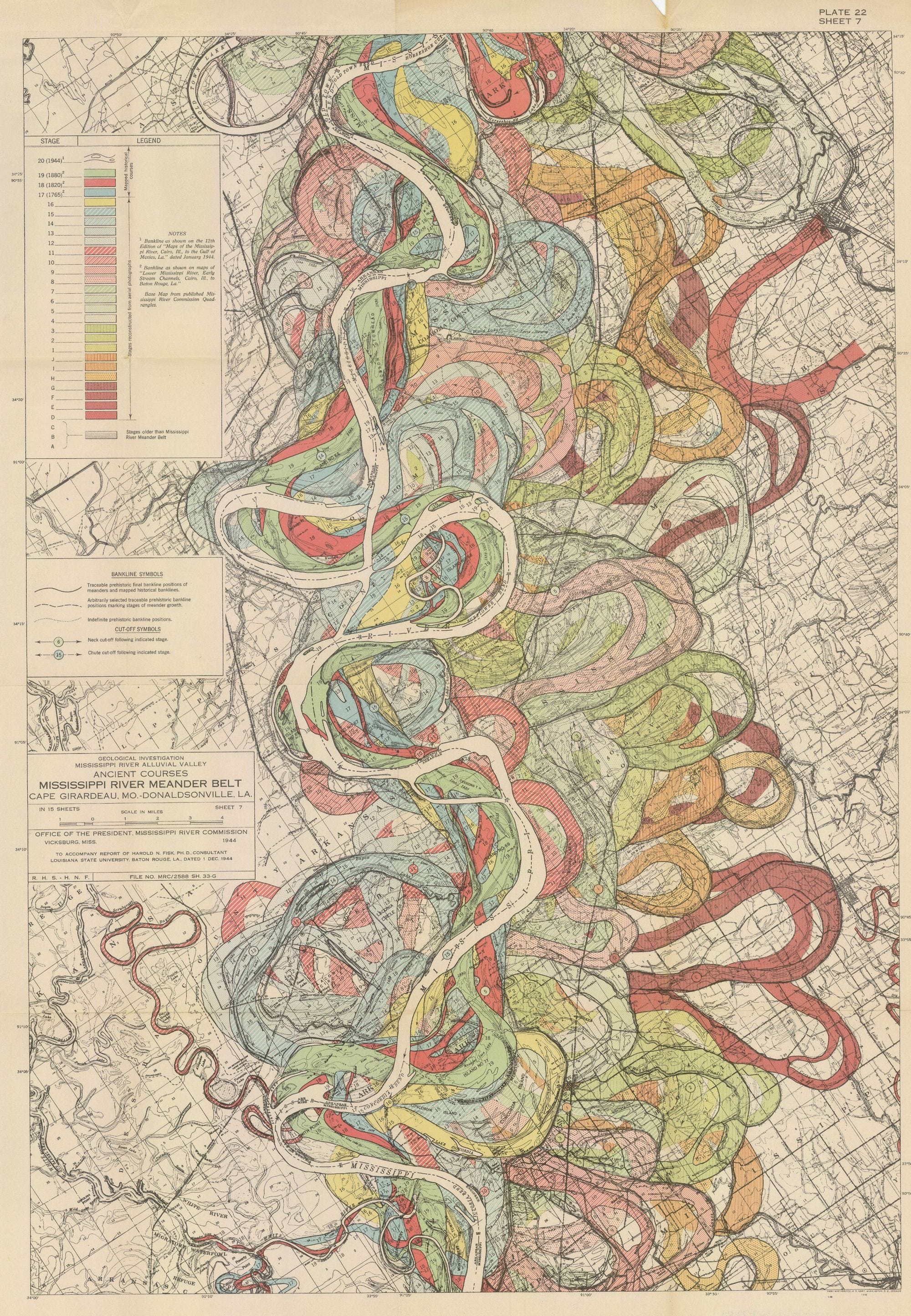
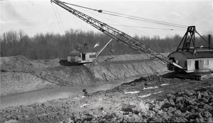
Or at least that was the case before steam power. 1850 saw the passing of the Swamp Land Act, a federal law that entitled previously un-farmable swamps, wetlands and bottomlands to state ownership. The states were then tasked with channelizing watercourses in order to move water off the landscape faster, then re-selling the newly arable land for agricultural production, often at an extremely low cost. The land sale proceeds were legally bound to be used for channelization, a “drain or default” clause. This channelization not only increased the mass of “productive” (and hence taxable) land, but paved the way for easily-crossed waterways; in order to increase and encourage the burgeoning railroad industry, the meandering and unpredictable course of our waterways needed to be subdued. The main tool of river and creek subjugation was the steam-powered dredge boat, and to a lesser extent, the walking dredge.
In the Florida Everglades, some 20 million acres of unique ecology were sold off to be bled dry. Thousands of acres of virgin cypress wetlands in Louisiana’s Atchafalaya basin were girdled and scalped by hissing machinery and steel teeth so that industry and state revenue might progress. Indiana’s Kankakee River was re-routed through a lacerated landscape to force the old form of ox-bows, meanders, and curling plumes of riverine life into that geometric symbol of complete and efficient resource extraction, the straight line. The river was no longer a great depositor of silty wealth to the maze of wooded bottomlands threaded through Eastern half of the continent, but a conveyer of waste, flushing sediment –and soon nutrients and chemicals– downstream to the eventual hypoxic zone of the Gulf of Mexico.
Where humans once travelled the sleepy, striding waters alongside sturgeon and gar and snapping turtles in boats that needed the safe, deep waters of lazy rivers, channelized cuts of rapidly running drainage ushered in the new era of rail travel, a technology that would not bow to the natural obstructions of a complete, balanced hydrological landscape. The ever-running lifeblood of mutilated swamps and plow-torn prairies began to down-cut the re-engineered waterways, gradually scouring the banks, tearing off immense chunks of that newly “reclaimed” farmland.
The cost of that ease of travel and increase in agriculturally productive land was erosion, habitat loss, and a slow poisoning of the continent’s most extensive watershed. By the turn of the 20th century, much of the US was carved into bureaucratic drainage districts, tasked with implementing this great straightening of the wild waters. It happened here on the North Fabius and the Wyaconda, a river some old-timers still refer to as “The Canal”*. Over in the Chariton River watershed, a channelization project performed in 1950 disemboweled the river of nearly 130 miles length to create the shortest path between two points– nearly half of its pools, riffles and meanders starved of water for the sake of corn and bridges.
But in some of those places where the screaming dredge boats bit off slices of riverbank, ripping root from earth, sucking dry the deep breeding pools of paddlefish and sturgeon, the earth’s broken circulatory system has found its old form, at least in floods— and in a world where floods are on the increase, straight lines cannot endure. In fact, they might get their ass whooped.
It’s above freezing now, and my dog is laid out in the tenuous sun that has threaded its way through the pall of morning cloud cover. A strange wind has picked up, shredding the last of the marcescent white oak leaves from their branches, revealing glossy buds, begging for heat. The leaky plumbing on a rain barrel drips, and the barren branches have begun to sway– a tinkling of golden-crowned kinglets flits up and down the stems of waking maples. The sap has begun to trickle, slow but consistent, and the glassy pools between the steep banks of the Long Branch, pregnant with roots, have begun to shatter in the thaw. I’ve begun to stick little flags down in the open pasture near the bottom edge of this slope, in places where I’ve seen the floodwaters rise on a handful of occasions, each one marking future plantings of crack-willow, pecan, sycamore, swamp white oak, and bald cypress; survivor trees for when this creek remembers its course.
The autumn of 1992 and spring of 1993 were exceptionally wet here in Northeast Missouri. The clay soils, without the buffer of wetlands and pump of native vegetation to regulate excess moisture, became saturated to a breaking point. Levees in the Fabius and Gregory drainage districts failed from within after months of saturation and high-water. The continued hydrologic pressure began to force water through the sand beneath the clay levees, and on July 16, 1993, the river decided to return home. Across the mouth of the Fabius, at the Mississippi River confluence in West Quincy, a levee was breached catastrophically, and a section of the bank blew out. In a short time, 14,000 acres of land were underwater– not just cropland, but businesses and homes. Water moved with such velocity that “scour-holes” were formed in some fields running 50 feet deep. Sand was deposited on the corn, returning the ‘reclaimed’ farmland back into a riverine sand bar.
Now, it would be remiss of me to not mention probably the only contemporary news story to come out of Northeast Missouri, which is that a man was convicted of sabotaging the levee, and he remains in jail today. James Scott was 24 years old at the time, and had a history of arson. He was volunteering on July 16, shoring up the compromised levee with sandbags. In a barstool confession, Scott bragged that he purposely removed sandbags and cut some protective plastic sheeting on the levee so that he could stay in Missouri and party while his wife was stranded on the Illinois side of the river.
He was convicted of an obscure “causing a catastrophe” law and sentenced to life in prison, which he is still serving, over 30 years later. In the trial, expert testimony from soil scientists from the University of Missouri stated that the levee failed on its own accord, that the stress of water saturation was too much, whether or not Scott moved a few sandbags around. At this point in the flood, 11 other levees upriver had already failed. Depending on who you ask around here, some folks say that Scott was set-up for vandalism, because documenting the flood damage as such allowed insurance payouts, since the flooding was defined as an “Act of God.”
The 2008 flooding was a bit different– while the 93 floods were due to saturation, 2008 was velocity. Significant snowmelt from the upper Midwest paired with an intense series of thunderstorms caused a series of violent surges in river level. While a meandering, naturally formed waterway has a tendency to reduce the velocity of surging waters, channelized rivers increase in speed and “headcutting” under such conditions, leading to what is known as “subaqueous scouring”. The fast moving water in channelized ditches moves so fast that the banks are annihilated, and levees are completely undermined by the surge. Areas that made it through the 1993 flood were inundated in 2008, because the water surged so incredibly fast– flash flooding on a massive scale.
In each instance, the river performed what is known as an “avulsion”, or a violent return to its previous route. Human beings can engineer, dredge, dam and levee these rivers, but ultimately, the water has its own way.
Returning to the mother maple, my dog curled in a ball near her root, her chest heaving with breath, I rattle more buckets for the faint splosh of sweet sap. As inefficient as it feels, to meander the bottomlands, checking on jugs of nothing, there’s at least some comfort in spending time with some survivor trees from decades of flood and drought, knowing that whether or not I gain anything from it, their cycles of xylem and phloem, rise and fall cannot be made to work on my time. Neither crooked trees or winding waters care for human measure.
The Long Branch sleeps, for now. Too jagged and wild for the engineers, it hums with cracking ice, soon waking. I can care for the banks to the best of my ability, monitor the water as it flows for a dozen crooked miles, but beyond that our control ends. I think these rivers remember… I know they do. The Chariton knows she was robbed of 130 miles, the Wyaconda, with its ghosts, recalls every lost meander, and the Fabius still echoes with the steam-powered shriek of dredge boats, made louder with new forms of fatal efficiency, from drain-tile to discharge pipes. Perhaps we’d be best to remember, too.
*There’s an old story from around here about a girl who drowned in those days. She was serving the boat crews working on the canal, walking planks from dredge to dredge with platters of food and drink… one dark evening she fell into the muddy water and was lost to the river, but they say you can still hear her clanking platter if you listen close out under the old bridge on Highway A.
The Fox Holler Almanac is a reader-supported publication— I couldn’t do it without you! Share or leave a comment if you liked it. Hell, leave a comment if you didn’t, though I might ignore it. And if you feel moved and able to materially support my work, upgrade your subscription or buy me a coffee.
Thanks, y’all.
In 14 years, we've had beavers visit twice. Both times, trappers have shown up and set their traps under the bridge, which is apparently legal-- the bridge butts up to our property line. Both times I enacted a campaign of sabotage, but the beavers moved on, probably on account of all the human activity. A couple years back, I read a book called Eager, by Ben Goldfarb. Really great read, it's all about beavers. They're probably the most trustworthy engineers you can find.
In Ireland we have something called the Arterial Drainage Act: "The Arterial Drainage Act was introduced after World War II to create more serviceable farmland and requires the Office of Public Works to continually re-dredge and drain 11,500 km of rivers. Again, this is designed to protected grazing pastures for livestock, not people or their homes." (https://www.thejournal.ie/readme/storm-chandra-nature-based-solutions-6946724-Feb2026/). Flooding events continue to increase, but nature-based solutions are a hard sell.